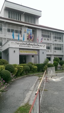
Local government office nearby อาคาร 14 กรมวิทยาศาสตร์การแพทย์ สธ.
Thailand
Local government office nearby อาคาร 14 กรมวิทยาศาสตร์การแพทย์ สธ.
อาคาร 14 กรมวิทยาศาสตร์การแพทย์ สธ.
Bang Khen, Mueang Nonthaburi District Tailandia
contacts phone
:
+66
Latitude:
13.8533022
, Longitude:
100.5319358
read more
nearest Local government office
404 m
กองแผนงาน
Bang Khen, Mueang Nonthaburi District
Local government office
read more
474 m
Bureau of Epidemiology
อาคารสำนักงานปลัดกระทรวงสาธารณสุข อาคาร 4 และ 6, ถนน ติวานนท์, ตำบล ตลาดขวัญ, อำเภอ เมือง
Local government office
read more
509 m
ศูนย์บริหารกฎหมายสาธารณสุข กรมอนามัย
Bang Khen, Mueang Nonthaburi District
Local government office
read more
510 m
กองยุทธศาสตร์และแผนงาน สำนักงานปลัดกระทรวงสาธารณุข
Tiwanon Road, Bang Khen, Mueang Nonthaburi District
Local government office
read more
510 m
กองเศรษฐกิจสุขภาพและหลักประกันสุขภาพ
อาคาร 7 ชั้น 4, Thanon Tiwanon - Pathum Thani, Bang Kraso, Mueang Nonthaburi District
Local government office
read more
510 m
กองเศรษฐกิจสุขภาพและหลักประกันสุขภาพ
อาคาร 7 ชั้น 4 ถนน ติวานนท์ - ซอย ติวานนท์ 20, Bang Kraso, Mueang Nonthaburi District
Local government office
read more
555 m
สำนักวิชาการสาธารณสุข
สำนักวิชาการสาธารณสุข อาคาร 2 ชั้น 6, สำนักงานปลัดกระทรวงสาธารณสุข ถนนติวานนท์, เมือง
Local government office
read more
587 m
สำนักงานบริหารยุทธศาสตร์สุขภาพดีวิถีชีวิตไทย
Bang Khen, Mueang Nonthaburi District
Local government office
read more
611 m
กลุ่มตรวจสอบภายในระดับกระทรวง กระทรวงสาธารณสุข
88/20 หมู่4, ซอยสาธารณสุข6, ตำบลตลาดขวัญ, Mueang Nonthaburi District
Local government office
read more
615 m
กองแบบแผน
Bang Khen, Mueang Nonthaburi District
Local government office
read more
659 m
สำนักงานสนับสนุนบริการสุขภาพเขต 4 จังหวัดนนทบุรี
Soi Satharanasuk 8, ตลาดขวัญ, เมือง
Local government office
read more
754 m
Ministry of Public Health
Luang Wichian Phaetthayakhom Alley, ตำบลตลาดขวัญ, Mueang Nonthaburi District
Local government office
read more
777 m
Department of Thai Traditional and Alternative Medicine
Bang Khen, Mueang Nonthaburi District
Local government office
read more
824 m
Thai fda
Bang Khen, Mueang Nonthaburi District
Local government office
read more
888 m
バンコク医薬品FDA事務所
Bang Khen, Mueang Nonthaburi District
Local government office
read more
1.056 km
สำนักงานประกันสังคม สำนักงานใหญ่ (Social Security Office)
88/28, ถนน ติวานนท์, อำเภอเมืองนนทบุรี
Local government office
read more
1.193 km
ศูนย์อ้างอิงทางห้องปฏิบัติการและพิษวิทยา
ชั้น 4 ตึกศูนย์ห้องปฏิบัติการกรมอนามัย ซอยโรงพยาบาลศรีธัญญา, ตลาดขวัญ, เมืองนนทบุรี
Local government office
read more
1.449 km
สำนักงานประกันสังคมเขตพื้นที่ 2
ึ70 ซอย 10 ถนน เทศบาลรังสรรค์เหนือ, Lat Yao, Chatuchak
Local government office
read more
1.549 km
บ้านนันทกานต์
Talat Kwan, Mueang Nonthaburi District
Local government office
read more
2.022 km
สำนักงานประกันสังคม จังหวัดนนทุบรี
ศูนย์ ราชการ จังหวัด นนทบุรี ถนน รัตนาธิเบศร์ ตำบล บาง กระ สอ อำเภอ เมือง จังหวัด นนทบุรี 11000, ถนน รัตนาธิเบศร์, ตำบล บางกระสอ, อำเภอเมืองนนทบุรี
Local government office
read more
2.022 km
สำนักงานประกันสังคม จังหวัดนนทุบรีบริการอย่างเหี้ย
ศูนย์ ราชการ จังหวัด นนทบุรี ถนน รัตนาธิเบศร์ ตำบล บาง กระ สอ อำเภอ เมือง จังหวัด นนทบุรี 11000, ถนน รัตนาธิเบศร์, ตำบล บางกระสอ, อำเภอเมืองนนทบุรี
Local government office
read more
2.022 km
สำนักงานประกันสังคม จังหวัดนนทบุรี
ศูนย์ ราชการ จังหวัด นนทบุรี ถนน รัตนาธิเบศร์ ตำบล บาง กระ สอ อำเภอ เมือง จังหวัด นนทบุรี 11000, ถนน รัตนาธิเบศร์, ตำบล บางกระสอ, อำเภอเมืองนนทบุรี
Local government office
read more
2.05 km
สถานพินิจและคุ้มครองเด็ก นนทบุรี
178, 49/38-178 Thanon Tiwanon - Pathum Thani, ตำบล ตลาดขวัญ, อำเภอเมืองนนทบุรี
Local government office
read more
2.103 km
(ป้าย) ศูนย์ราชการจังหวัดนนทบุรี
Rattanathibet Road, Bang Kraso, Mueang Nonthaburi District
Local government office
read more
2.179 km
Nonthaburi Government Center
Rattanathibech 6 Alley, Bang Kraso, Mueang Nonthaburi District
Local government office
read more
📑
all categories
Accounting
Administrative area level 1
Administrative area level 2
Airport
Amusement park
Aquarium
Art gallery
Atm
Bakery
Bank
Bar
Beauty salon
Bicycle store
Book store
Bowling alley
Bus station
Cafe
Campground
Car dealer
Car rental
Car repair
Car wash
Casino
Cemetery
Church
City hall
Clothing store
Colloquial area
Convenience store
Courthouse
Dentist
Department store
Doctor
Electrician
Electronics store
Embassy
Finance
Fire station
Florist
Food
Funeral home
Furniture store
Gas station
General contractor
Grocery or supermarket
Gym
Hair care
Hardware store
Health
Hindu Temple
Home goods store
Hospital
Insurance agency
Intersection
Jewelry store
Laundry
Lawyer
Library
Light rail station
Liquor store
Local government office
Locality
Locksmith
Lodging
Meal delivery
Meal takeaway
Mosque
Movie rental
Movie theater
Moving company
Museum
Natural feature
Neighborhood
Night club
Painter
Park
Parking
Pet store
Pharmacy
Physiotherapist
Place of worship
Plumber
Point of interest
Police
Political
Post office
Premise
Real estate agency
Restaurant
Roofing contractor
Route
Rv park, camping
School
Shoe store
Shopping mall
Spa
Stadium
Storage
Store
Subpremise
Subway station
Supermarket
Synagogue
Taxi stand
Train station
Transit station
Travel agency
University
Veterinary care
Zoo
sublocality level 1
sublocality level 2
↑